Mapping sika deer home range
Fit individuals and map their home range. Quantify use of farmland, plantation forests, and feeding sites — base data for the Type II Specified Wildlife Management Plan and the Designated Wildlife Capture Initiative.
Home range and wintering grounds for sika deer — at the precision your management plan needs.
For municipalities, research institutions, and forestry operators managing sika deer (Cervus nippon): the LoggLaw G2C deer model is purpose-built for home-range analysis, wintering-ground identification, and agro-forestry damage management.
A dedicated deer model (345g) sized for sika deer body conformation. The cotton collar strap degrades naturally and drops off within 2–3 years — no recapture required for retrieval.
Built-in solar charging minimizes the need to re-capture deer for battery service. LTE-M sends data directly over the cellular network nationwide.
In March 2026, the LoggLaw G2C was used in the first confirmed record of sika deer wintering in Kamikochi (Shinano Mainichi Shimbun reported).
A GPS collar for sika deer (Cervus nippon) — including the Yezo sika subspecies (C. n. yesoensis) — is a tracking device worn on the neck that logs latitude and longitude via satellite positioning and uploads data over a cellular network. Unlike VHF telemetry, which requires an operator on site to triangulate signals, a GPS collar enables continuous, remote tracking of individual home range, movement routes, wintering grounds, and feeding-site use.
Sika deer are a primary driver of agro-forestry damage in Japan and are designated by the Ministry of the Environment as one of the Designated Managed Wildlife species (alongside wild boar). A GPS collar quantifies use of farmland, plantation forests, feeding sites, and wintering grounds — providing objective evidence for fence design, capture planning, and the Type II Specified Wildlife Management Plan.
This page details the LoggLaw G2C deer model — its specifications, use cases, and deployments across Japan.
Damage caused by sika deer is hard to address without precise data on home range, seasonal movement, and feeding-site use. GPS collars provide data that visual surveys, track surveys, and camera traps cannot.
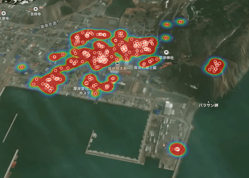
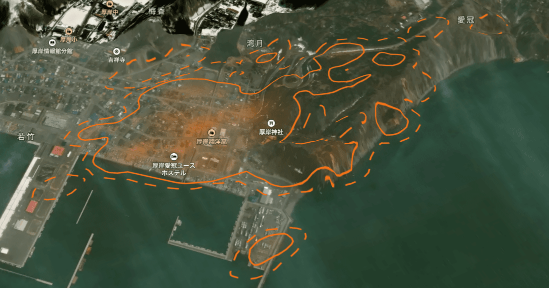
Sika deer home ranges span tens to hundreds of hectares. A GPS collar quantifies an individual's used area as map-based polygons (KDE 50% / 95% contours), enabling objective evaluation of farmland, plantation, and feeding-site use frequency.
Sika deer shift their range seasonally depending on snowfall and forage. Annual GPS data identifies wintering grounds, summer ranges, and movement routes — informing the timing and location of capture and damage-prevention measures. In March 2026, the LoggLaw G2C contributed to the first confirmed sika deer wintering record in Kamikochi.
From GPS tracks, you can analyze intrusion timing, routes, and dwell time at farmland, plantation forests, and nursery sites — informing electric-fence and deer-fence placement and prioritization of protected areas.
Within the Type II Specified Wildlife Management Plan and the Designated Wildlife Capture Initiative, sika GPS data calibrates population and density estimates and verifies the effectiveness of capture pressure.
The LoggLaw G2C comes in dedicated monkey and deer models. The deer model is sized for sika and Yezo sika deer body conformation. Attachment method and the collar-to-body-weight ratio require careful evaluation from an animal-welfare standpoint — we advise on deployment based on the specific operation.
| Deer model weight | 345g (including collar strap) |
|---|---|
| Target species | Sika deer (Cervus nippon), Yezo sika deer (C. n. yesoensis); also deployed on Japanese serow |
| Communication | LTE-M (Cat-M1) / NTT Docomo & Softbank 4G coverage |
| Positioning | GPS / GNSS (~20m accuracy) |
| Power | Built-in solar; ~1 year without solar input (under 12 GPS fixes/day, 1 transmission/day) |
| Transmission interval | Default several times/day; remotely switchable down to 2-minute GPS fixes / 5-minute uploads |
| Waterproof / Temperature | Fully waterproof / -10°C to 40°C (deployed in snowy / cold regions) |
| Collar strap | Cotton (degrades naturally over 2–3 years; drops off the animal) |
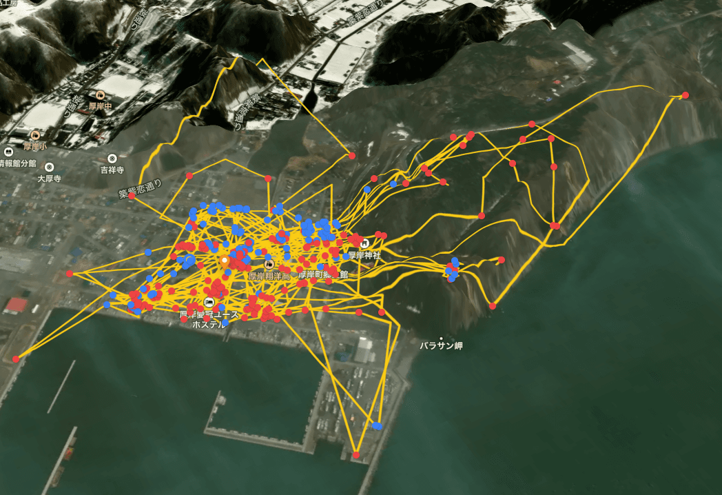
Real tracks from sika deer fitted with LoggLaw G2C GPS collars. Data is automatically uploaded over LTE-M and visualized as home range, routes, and wintering grounds on Animal Portal.


Representative use cases of the LoggLaw G2C deer model in municipal, research, and forestry deployments.
Fit individuals and map their home range. Quantify use of farmland, plantation forests, and feeding sites — base data for the Type II Specified Wildlife Management Plan and the Designated Wildlife Capture Initiative.
Annual data identifies wintering grounds where sika deer concentrate. Capture efforts can be focused on those locations for efficient population control. Case study: first confirmed sika deer wintering record in Kamikochi.
Analyze intrusion timing, routes, and dwell time at farmland, plantation forests, and nurseries. Optimize electric-fence and deer-fence placement and verify effectiveness.
Annual data reveals seasonal movement between summer and winter ranges driven by elevation, vegetation, and snow depth — supporting prediction and proactive measures. For Yezo sika, also useful for analyzing low-elevation migration in deep-snow years.
Register the locations you want to protect — homes, fields, settlement boundaries — on Animal Portal, and a Proximity Alert auto-emails registered users when a deer reaches three distance bands (Critical 300m / Warning 600m / Caution 1,000m). Polygon-area Geofence alerts for entry / exit detection are coming soon.
Sika and Yezo sika behavioral ecology, population dynamics, habitat use, anthropogenic-impact studies — used in research collaborations as well. As a Kyoto University-affiliated manufacturer, we support consultations from the study design stage onward.
GPS collars for sika deer vary significantly in operational feel depending on the communication scheme. The criteria below matter most for sika deer management.
| Criterion (for sika deer ops) | Base-station deer GPS collar | Direct LTE-M deer GPS collar (LoggLaw G2C) |
|---|---|---|
| Wide-ranging / seasonal movement | Data gaps outside base-station range | Continuous capture across LTE-M coverage |
| Mountain / cold-region operations | Base-station maintenance can be difficult | Fully waterproof, -10°C operation; track record in snowy and cold regions |
| Re-capture burden (power) | Re-capture required at battery end-of-life | Built-in solar minimizes re-capture |
| Operator infrastructure | Local base station, power, maintenance | Cloud only; no field infrastructure |
| High-frequency mode | Fixed transmission intervals on most models | Remote switch to 2-minute fixes / 5-minute uploads |
| Subsidy (Japan) | Varies by product | Wildlife Damage Prevention Comprehensive Subsidy eligible |
* The comparison above describes general characteristics of the two communication designs and is not exhaustive of any specific vendor's product.
As of May 2026, the LoggLaw G2C is deployed across 25 prefectures and 65+ municipalities, research institutions, and companies. Among these, the collar is in active use for sika deer (Cervus nippon) and Yezo sika deer damage management and behavioral research. In March 2026, the device was used in the first confirmed sika deer wintering record in Kamikochi (Shinano Mainichi Shimbun reported).
Eligible under the Japanese Ministry of Agriculture, Forestry and Fisheries' Wildlife Damage Prevention Comprehensive Subsidy program. Based on the municipal damage-prevention plan, costs for the LoggLaw G2C deer collar may be covered by the subsidy. Please contact your municipal office or local agricultural office for details.
Data from the LoggLaw G2C is visualized on Animal Portal: map-based visualization, KDE home-range calculation, simultaneous management of multiple individuals, sighting-information sharing, and capture-report management. A built-in Proximity Alert auto-notifies registered users at three distance bands (Critical 300m / Warning 600m / Caution 1,000m). CSV and GeoJSON export plus PDF reports make integration with existing GIS environments straightforward. Polygon-area Geofence alerts for entry / exit detection are coming soon.
Learn more about Animal PortalFull guide to selecting a GPS collar for monkeys, deer, and bears — communication, power, subsidy use.
Learn moreDetailed specifications for the monkey and deer (345g) models — communication, power, waterproof rating.
Learn moreThe operations cloud for sika deer GPS collars — map visualization, multi-individual management, sighting sharing, capture-report management.
Learn moreWe support municipalities, research institutions, and forestry operators in tailoring the GPS collar deployment to the target individuals, study area, and operations workflow — including subsidy use and field trials. Please get in touch.