Animal Portal
Comprehensive cloud platform for wildlife damage prevention, integrated with 'LoggLaw G Series' GPS collars
What is Animal Portal?
Animal Portal is a cloud-based wildlife tracking and management platform operated by Biologging Solutions Inc., a Kyoto University-affiliated biologging equipment manufacturer. It integrates with LoggLaw GPS collars and is used by municipalities, universities, and research institutions.
Animal Portal belongs to the category of services often referred to in the field as a wildlife management platform, wildlife damage management cloud, human-wildlife conflict management software, or GPS collar management cloud. It integrates with the LoggLaw G series of GPS collars to unify positioning data, proximity alerts, capture reports, and sighting information from deployed individuals.
A Look Inside the Portal
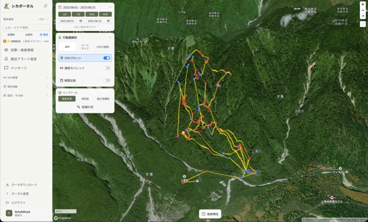
View GPS collar data on an interactive map in real time. Check current location, movement tracks, and home ranges from both desktop and mobile, with no setup required.
Key Features
An international patent application is pending for technology related to Animal Portal.
GPS Movement Visualization
View current location, movement trajectory, and home range of tracked animals as real-time heatmaps. Accessible from PC or smartphone anytime.
Proximity Alert Function
Register your home or fields to receive email alerts when animals approach. Three levels: Caution (1,000m), Warning (600m), and Emergency (300m).
See how Proximity Alert differs from GeofenceSighting Information Sharing
Post and aggregate date, location, traces, damage status, and photos from the field. Overlay with GPS data on the map.
Advanced Map Display
Support for GSI standard maps, satellite/aerial imagery (2D/3D), and topographic maps (2D/3D). Accurate situational awareness matching the terrain.
Team Collaboration
Share information in real time among local stakeholders. Digitize paper-based reporting for efficient collaboration.
Support for Various Wildlife
Supports six species: monkeys, bears, deer, wild boar, raccoons, and cormorants.
Smartphone Compatible
Post sighting information from the field via smartphone. Check GPS data while on the go.
Long-Term Operation
Works with the LoggLaw G Series. Solar panel equipped for years of continuous operation.
Use Cases
Bear & Monkey Monitoring
Detect animals approaching settlements early for resident alerts and deterrence. Prevent damage before it occurs.
Identifying Home Ranges
Use heatmaps to identify areas of frequent animal activity. Optimize trap placement and buffer zone development.
Digitizing Damage Reports
Digitize paper-based sighting and damage reports for real-time community-wide sharing. Enable rapid response.
Community-Wide Countermeasures
Municipalities, experts, farmers, and residents share information on one platform. Drive effective regional measures.
Field-Operation Support
Beyond visualizing location data, Animal Portal digitizes the entire on-the-ground workflow: capture, deterrence, and report preparation.
Capture Report Management
Record capture date, location, sex, age class, and method with photos. Aggregate through an approval workflow and export to PDF / Word.
Deterrence Schedule & Ranking
Schedule and manage community deterrence activities. A points-based ranking encourages continued resident participation.
Automated Reports
Auto-generate monthly, quarterly, and annual reports with statistical charts, GPS track maps, and approaches to each settlement, streamlining materials for review meetings and administrative reporting.
Visit Forecast (Japanese Macaques)
Predict Japanese macaque troop visits with a forecasting model, with email alerts by probability level for proactive, ahead-of-time response.
Wildlife-Management Knowledge Base
A library of wildlife-damage countermeasure know-how, retaining field expertise across staff turnover and generational change.
Public Map
Share sightings and GPS heatmaps with residents, no login required, to promote community-wide awareness and information sharing.
What Animal Portal Can Do
From visualizing location data to sharing information with residents, managing deterrence and capture activities, and preparing reports, here is the full list of what Animal Portal covers.
| Feature | What you can do | Availability |
|---|---|---|
| GPS location visualization | Real-time map display of each collared animal's current position, movement track, home range (KDE), and residence-density heatmap. | Available |
| Proximity alerts | Email and push notifications at three distance levels (300 m / 600 m / 1,000 m) when animals approach registered points such as homes or fields. | Available |
| Geofencing (area alerts) | The GPS collar itself detects entry into and exit from freely drawn polygon areas on the map and sends a notification. | Beta |
| Visit forecasting (Japanese macaques) | Forecast per-settlement visit probability from GPS data, with advance email and push alerts by probability level. | Beta |
| Sighting & damage reporting | Submit date, location, signs, damage status, and photos from a smartphone in the field. Reports are stored offline when out of coverage and sent once connectivity returns. Sightings, damage, and captures are overlaid on the map in color by type, with species filtering and a density (heatmap) view. | Available |
| Public map for residents | A login-free public map publishing movement tracks / heatmaps (with day-night filtering), sighting information, and announcements for residents. Settlement names are labeled on the map, and when viewers allow location access, the map zooms in on tracking data near their location if any is found. | Available |
| Deterrence activity management | Schedule community deterrence activities and manage participation. Residents choose their settlement to join its schedule, and can log a sighting together with an activity report. A points-based ranking encourages continued involvement. | Available |
| Trap management | Manage trap locations, types, and status on the map, linked to patrol records and capture results. Members such as local hunters can register their own traps, and selecting the trap used in a capture report logs the capture automatically. Trapping license and capture permit expiry dates are tracked, with expired and soon-to-expire items flagged in the list. | Available |
| Fence management | Register electric, wire-mesh, metal-sheet, net, and composite fences as map lines and track their status (active / damaged / under repair / removed). Inspection, repair, and damage reports are logged with voltage readings (kV) and photos. Funding source, program name, fiscal year, and service life can be recorded for subsidized fences, with filtering and CSV export of the fence ledger. | Available |
| Settlement inspection | Record problem sites across four categories (attractants, entry routes, fencing, and hiding places) with urgency, resolution status (open / in progress / done / monitoring), assignee, and before-and-after photos. | Available |
| Capture report management | Record capture date, location, sex, age class, and method with photos, and aggregate them through an approval workflow. | Available |
| Troop management (Japanese macaques) | Keep a register for each troop and record headcount surveys to follow changes over time. Link GPS collars to troops for defined periods, and organize capture reports and sightings by troop, with approved captures tallied automatically by sex and age class. | Beta |
| Member activity ledger | List each member's trap patrols, captures, settlement inspections, and deterrence reports by fiscal year, with CSV export, to support recruiting and recognizing local participants. | Beta |
| Trail camera management | Manage trail camera locations and capture records alongside GPS and sighting data on the same map. | Available |
| Roost management (cormorants) | Register and update cormorant roost and colony locations and sizes, and view their distribution on the map. | Available |
| Automated report generation | Auto-generate monthly, quarterly, and annual reports with statistical charts, exportable to PDF / Word. Reports include GPS track maps, sighting and damage distribution maps, approaches to each settlement, and comparisons with the previous period, plus monthly trend charts for quarterly and annual reports. A home-range (KDE) area comparison between two periods can be added as an option (preview and PDF). | Available |
| Data export | Export GPS data as CSV and KML, and home ranges (KDE) as GeoJSON. Trap, trail camera, and roost records can also be exported as CSV, and the bulk export for QGIS bundles layers such as sightings, damage, culling records, fences, inspections, and traps. | Available |
| Remote collar configuration | Change collar settings such as fix interval remotely from the screen, with automatic confirmation and notification once applied, and an alert if the settings are not received in the expected time. | Available |
| App-like use on smartphones (PWA) | Add to the home screen for one-tap launch, with push notification support for proximity alerts and more. Tapping a notification opens the map with the relevant GPS collar selected. | Available |
| Knowledge base | Illustrated articles on wildlife-damage countermeasures, covering the ecology of each species, electric fences and traps, using GPS data, and capture permit procedures. Field expertise stays with the organization across staff turnover. | Available |
| Advanced map layers | Supports GSI standard maps, satellite and aerial imagery (2D / 3D), and topographic maps (2D / 3D). | Available |
| Supported species | Six species: Japanese macaque, wild boar, sika deer, bear, raccoon, and great cormorant. | Available |
| Compatible hardware | LoggLaw G Series GPS collars. LTE-M communication removes the need for receivers, and solar panels enable years of operation. | Available |
* Features marked "Beta" are available as a beta (trial) release on the new Animal Portal. The existing portal also remains available. Open the new Animal Portal (animal-portal.jp)
Analysis Output Examples
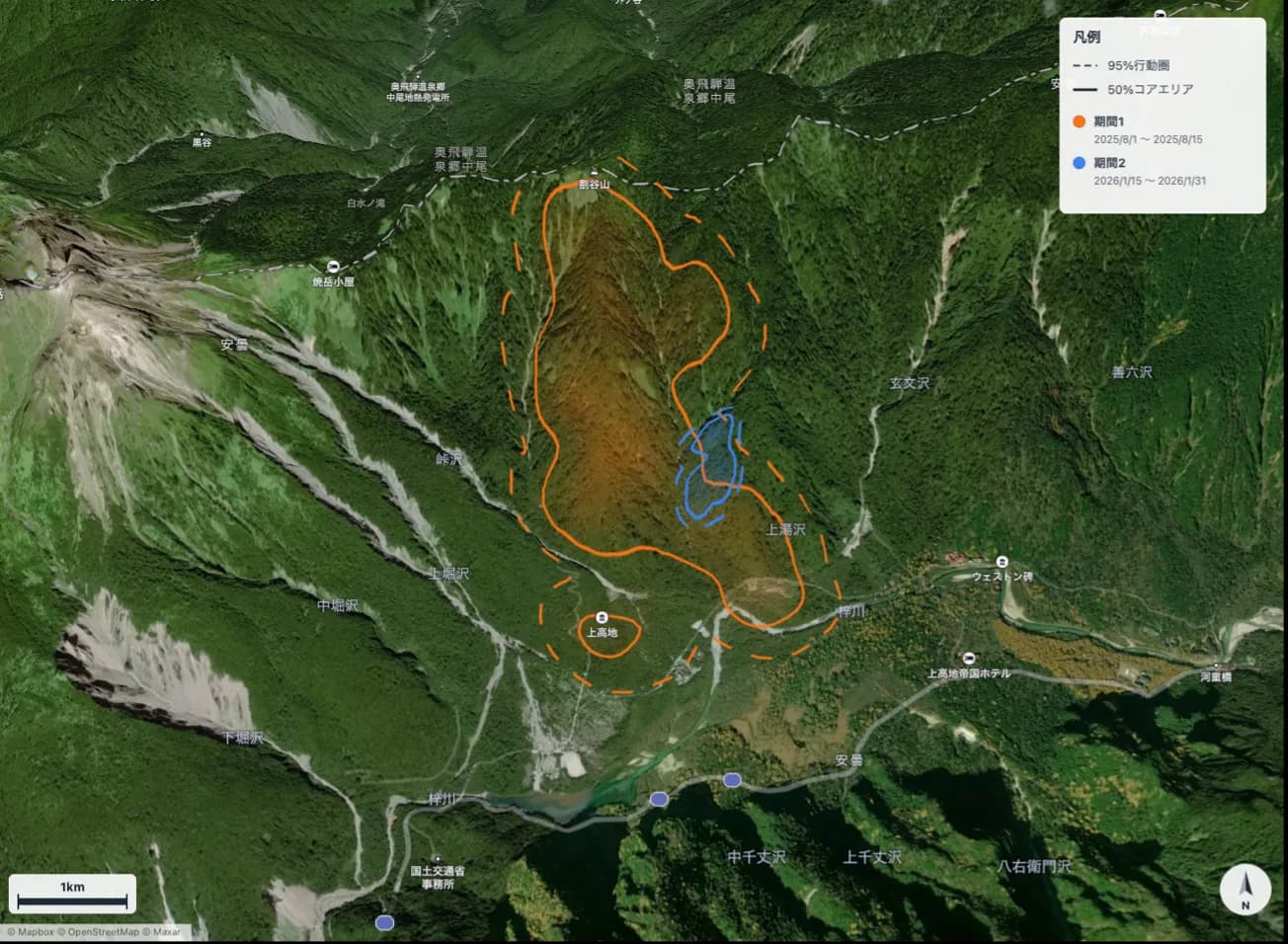
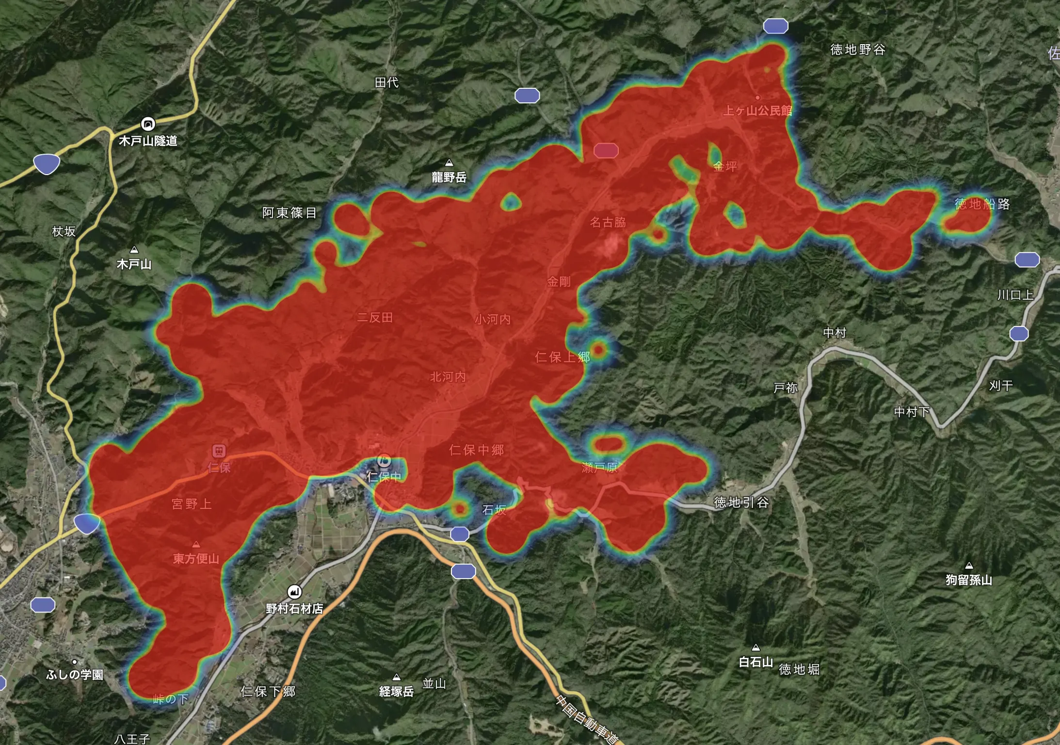
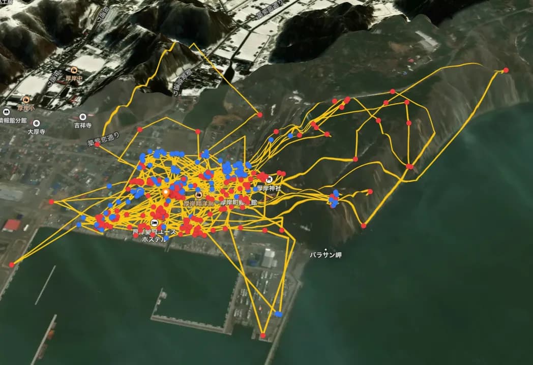
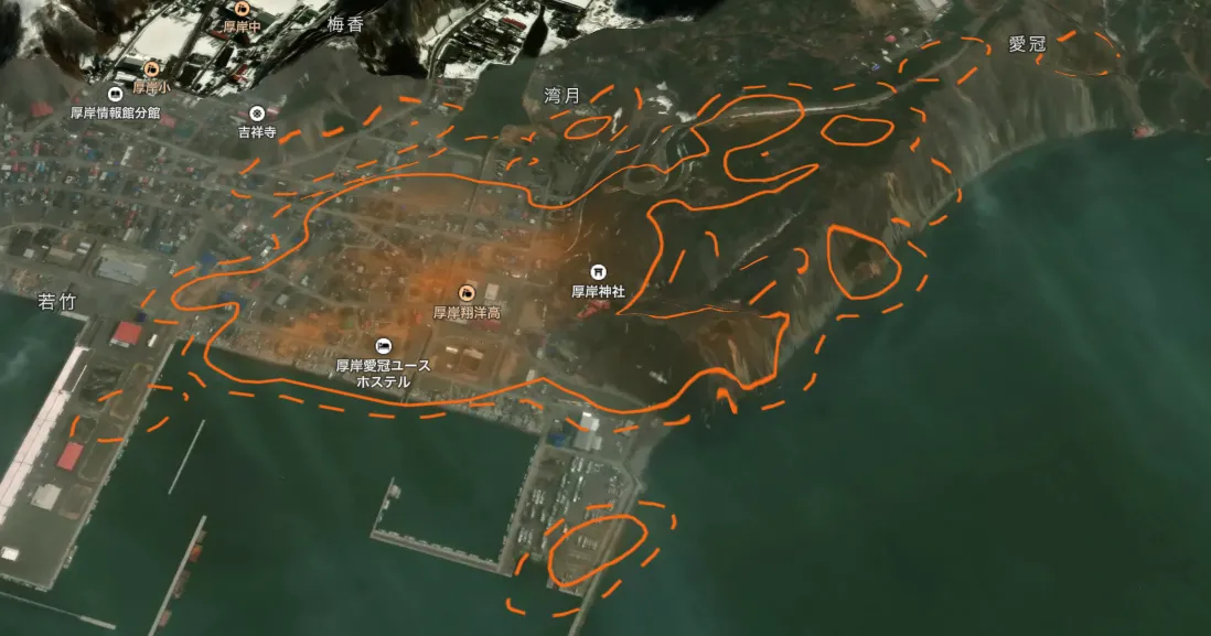
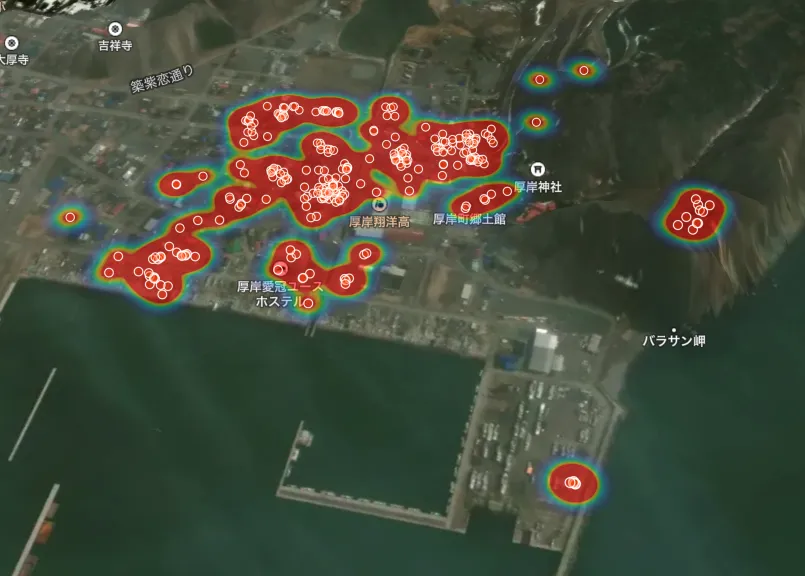
GPS data is automatically rendered in three formats (tracks, KDE home ranges, and heat maps), ready to use in reports and community wildlife-management meetings.
Japanese Macaque
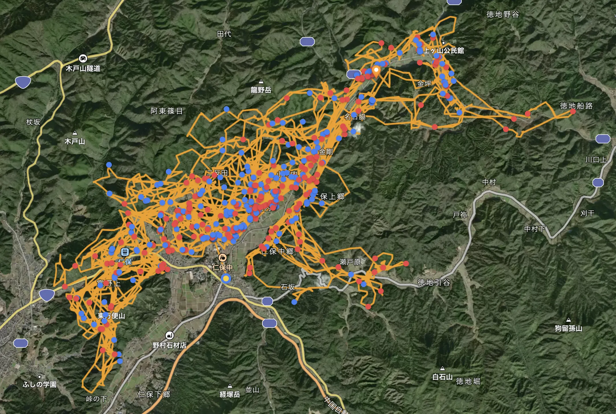
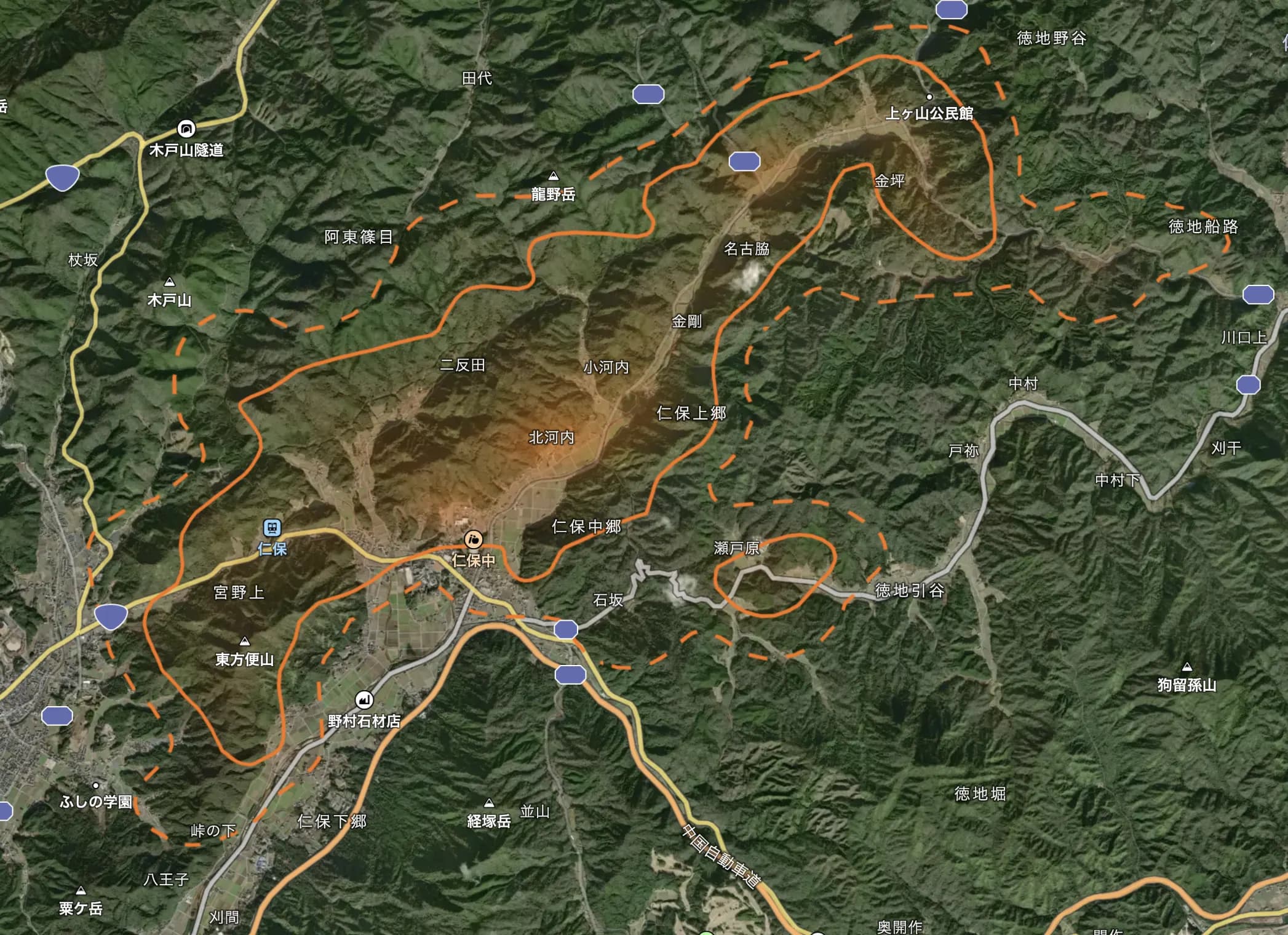
Sika Deer
Who Can Use It
Local Governments & Administrative Bodies
Use as a foundation for community-based wildlife damage prevention, providing residents with information and planning countermeasures.
Researchers & Experts
Use for wildlife home range analysis, ecological surveys, and improving capture efficiency.
Farmers & Local Residents
Use for early warning, information sharing for damage prevention, and efficient deterrence.
Compatible Hardware
LoggLaw G Series
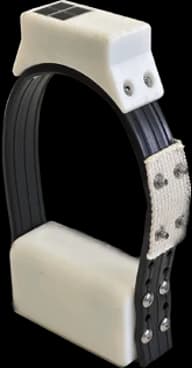
Next-generation GPS collar for wildlife damage prevention. LTE-M communication eliminates the need for receivers; solar panel enables long-term operation.
- • LTE-M communication: Transmits data over cellular network, no receiver installation required
- • Solar panel: Years of continuous operation
- • Fully waterproof & rugged: Designed for harsh wildlife environments
- • Subsidy eligible: Qualifies for 'Wildlife Damage Prevention Comprehensive Measures Grant' etc.
Frequently Asked Questions
Can we share wildlife sighting information with residents and local stakeholders?+
Can it be used to manage community deterrence activities?+
Does it support capture reporting and administrative reports?+
Can it manage electric fences and protective fencing?+
Is it usable by non-researchers?+
Which species does it support?+
Can it be used on a smartphone alone?+
How does it differ from other animal location tracking systems?+
Ready to digitize your wildlife damage prevention?
Achieve effective wildlife damage prevention with Animal Portal and LoggLaw G Series.