UX Niigata TV 21 Reported on Sanjo City’s Monkey Control Measures | We’re Sharing the Troop’s Movements via Our GPS Collars and Animal Portal
On October 21, 2026, UX Niigata TV 21 aired and streamed a news segment titled “Damage to Crops on the Rise… Using GPS to Track Monkey Herds [Niigata, Sanjo City].”The report introduced an initiative in Sanjo City, Niigata Prefecture, where GPS collars have been fitted to a monkey troop and their location data is being published on a dedicated website. Our GPS collar, “LoggLaw G2C,” and our wildlife data management cloud platform, “Animal Portal,” are being used for these collars and the dedicated website.
Article (Yahoo! News):
https://news.yahoo.co.jp/articles/a56fcf4deaeb3b3f3b40636f95ee586216aaf318
動画 (YouTube):
https://youtu.be/HPynObWNdW8
Summary of the Report
According to reports, in Niigata Prefecture, damage to crops caused by wild birds and animals reached a record high of approximately 460 million yen in fiscal year 2025.In Sanjo City, damage caused by monkeys has been increasing in particular; since some individuals have been breaking through electric fences to enter fields, the Wildlife Damage Prevention Council—comprising the city government, hunting associations, and other groups—is simultaneously conducting capture operations and patrols.
The council is fitting captured monkeys with GPS-equipped collars and monitoring the troop’s movements via a dedicated website. As of the time of the report, three monkeys are wearing the collars. A representative from Sanjo City’s Agriculture and Forestry Division stated in the program that, whereas locals previously could only speculate that “they might be coming soon,” the troop’s movements are now visible through the data.The council hopes citizens will also make use of the website—for example, by increasing their vigilance when the troop approaches.
Products and Services Used
- LoggLaw G2C (Collar-Type GPS for Wildlife Damage Control) — A GPS collar equipped with LTE-M communication and a solar panel. It automatically transmits positioning data to the cloud.
- Animal Portal (Wildlife Data Management Cloud) — A cloud service that displays the location data from GPS collars on a map and allows it to be shared with relevant agencies and residents.
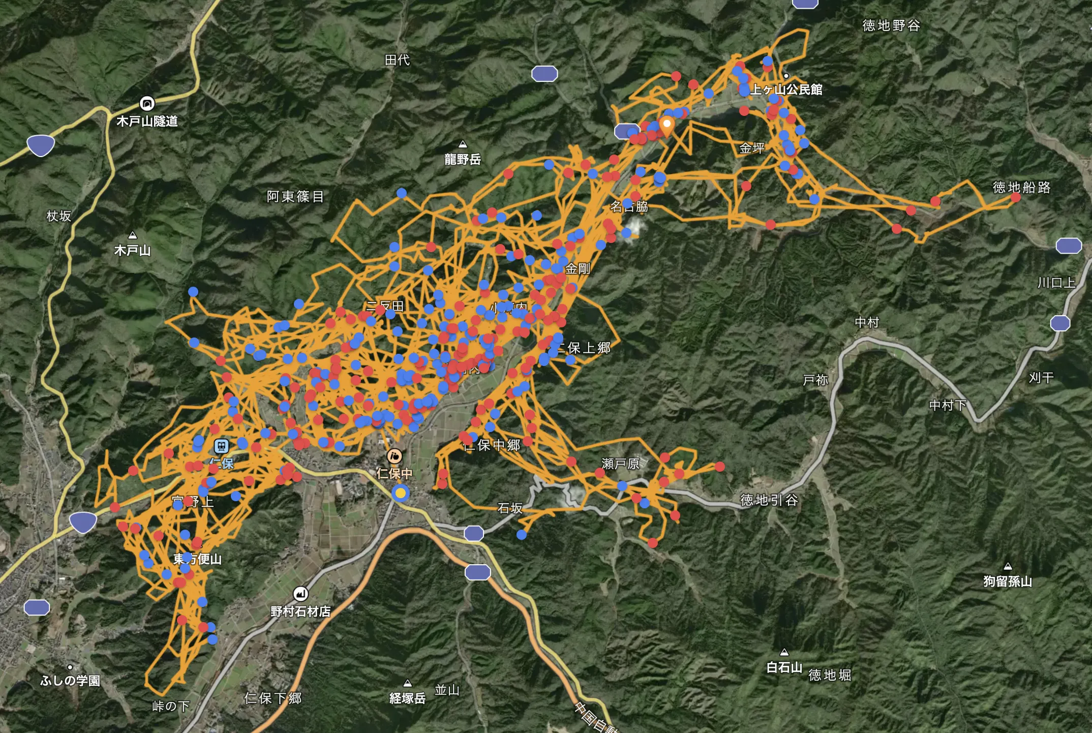
We will continue to collaborate with local governments to support initiatives that use data to track the locations of animal herds and apply this information to damage prevention measures.
Related Products and Services
GPS Collars for Monkeys — Japanese Macaque Troop Management
This section explains how to fit Japanese macaque troops with GPS collars to track their home ranges and activity patterns, and utilize this data to implement damage prevention measures.
LoggLaw G2C — Collar-Type GPS for Wildlife Damage Control (GPS Collar)
A collar-type GPS designed for medium- to large-sized animals. It combines GNSS positioning, LTE-M communication, and a solar panel to enable long-term, real-time tracking in mountainous areas. For explanations specific to each target animal, please also see the pages on GPS Collars for Deer and GPS Collars for Bears.
Animal Portal — Cloud-Based Wildlife Data Management
A cloud platform that allows you to visualize and share GPS data collected by the LoggLaw G Series in real time. It supports the display of activity ranges on maps, proximity alerts, and data sharing among multiple organizations.